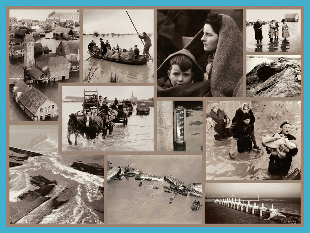
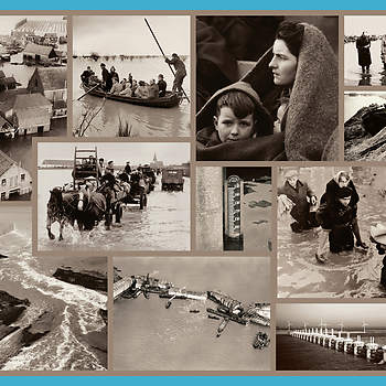
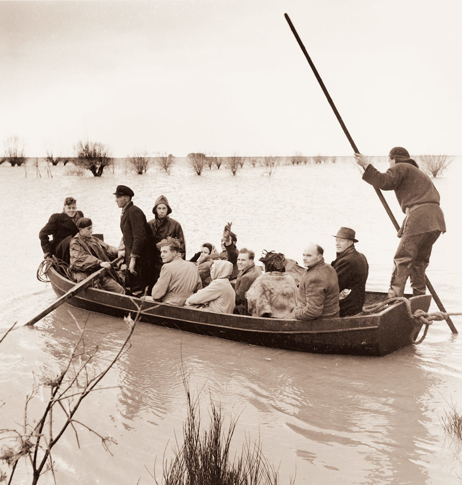
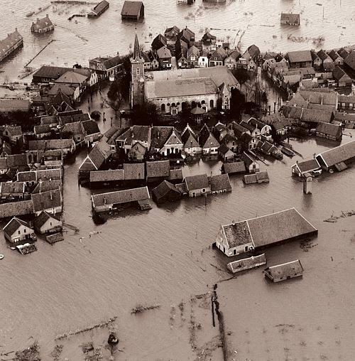
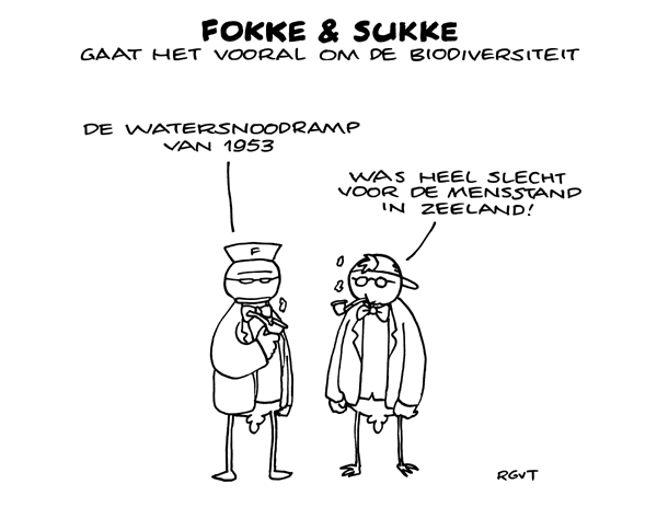
The disastrous night of 1953
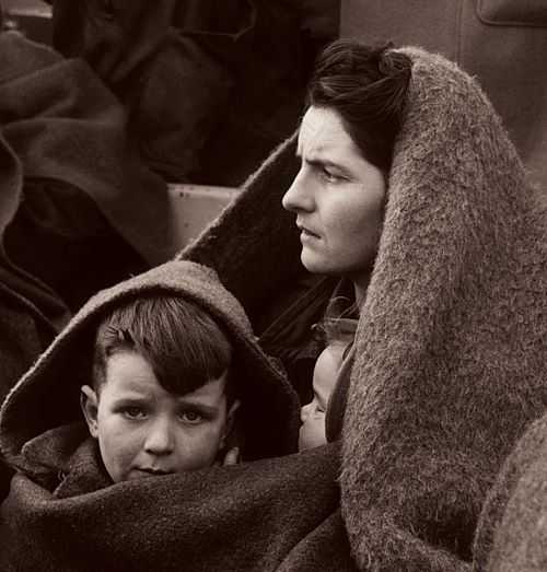
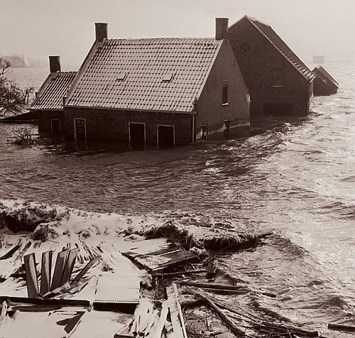
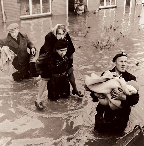
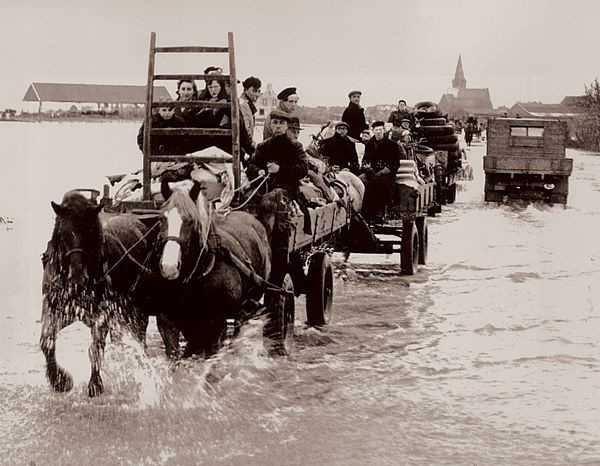
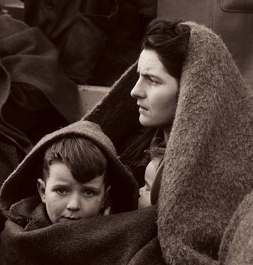
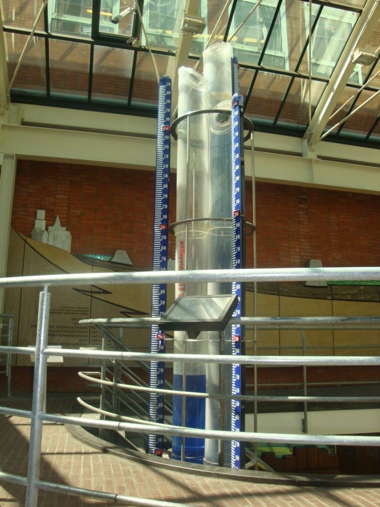
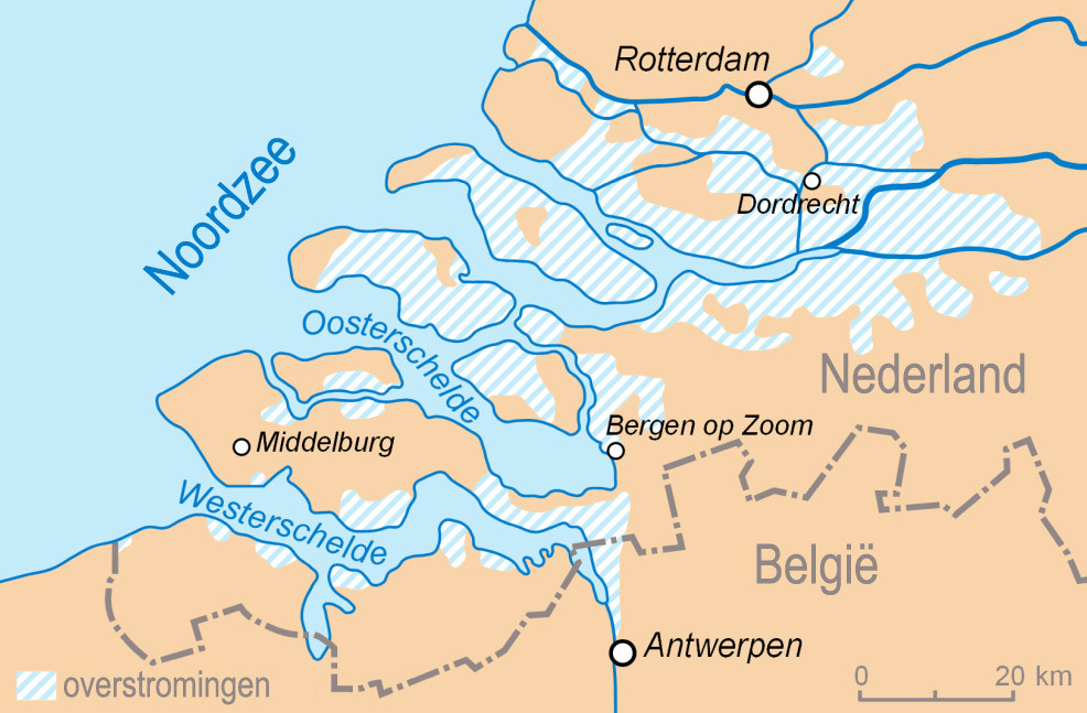
In the night of 31 January - 1 February 1953, a severe storm surge hits Zeeland, West-Brabant, and the South Holland islands. Many dykes burst. The icy cold water has a devastating impact: 200,000 hectares of land are flooded, 1836 people lose their lives, tens of thousands of animals drown, and 72,000 are left homeless. It is a national disaster.
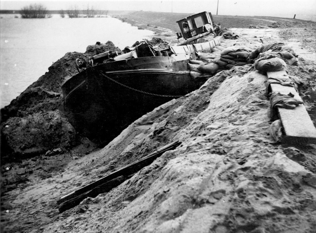
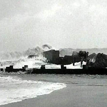
Immediate action along the Hollandse IJssel river manages to prevent a far worse disaster. When the dyke near Nieuwerkerk aan den IJssel starts to give way, a ship is navigated into the breach, and as a result, the dyke holds. Behind this dyke lies the lowest part of the Netherlands, some of which is situated up to seven metres below sea level. The area accommodates more than a million people.
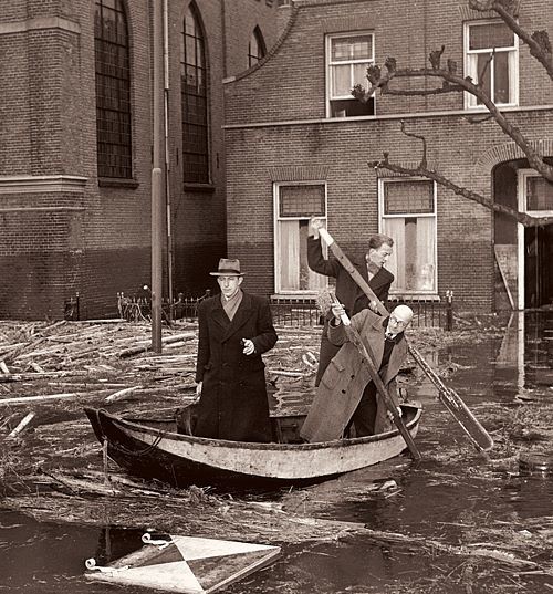
All over the Netherlands, clothing and money is collected. Evacuees are warmly welcomed, and aid also arrives from abroad. For example, a large number of wooden emergency houses are donated for families left homeless. Closing all the dykes that have burst takes until the end of 1953.
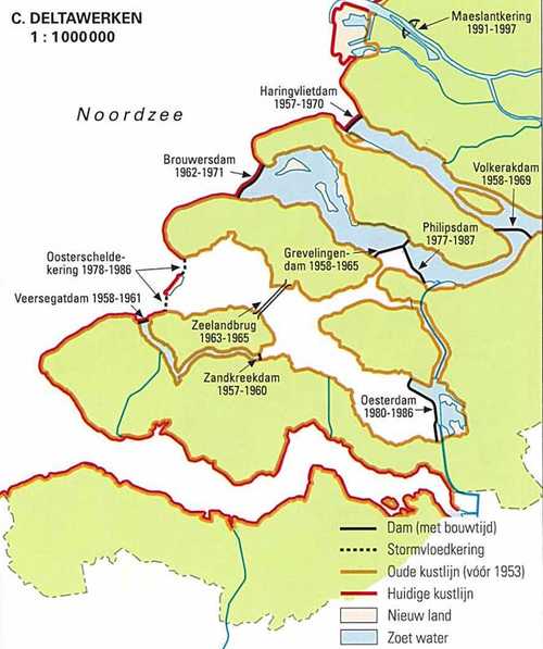
The Delta Works
As early as the 1930s, hydraulic engineer Johan van Veen warns about a disastrous flood, but virtually no-one listens. The existing plans for coastal reinforcement are continuously put on hold, on account of World War II and the post-war reconstruction. Towards the end of January 1953, Van Veen submits his Delta Plan to his superiors at the Ministry of Public Works. A few days later, the dykes give way.
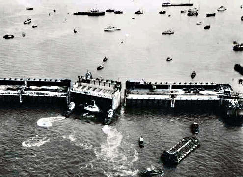
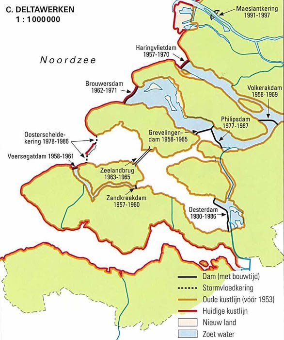
After the disaster, the authorities are quick to start implementing Van Veen’s plans: a system comprising several dams and flood defences to protect the southwestern part of the Netherlands against flooding. A storm surge barrier is created on the Hollandse IJssel river. All the tidal inlets between the South Holland and Zeeland islands are closed off by dams, except for the Westerschelde. The sea and river dykes are improved. This pioneering project is one of the most sophisticated hydraulic achievements in the world. Its masterpiece is the closable storm surge barrier in the Oosterschelde, which was put into operation in 1986.
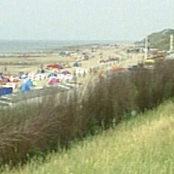
This huge project provides the southwest of the Netherlands with far better flood protection. At the same time, new dams and dykes improve access to the Zeeland islands – which boosts the development of industry and tourism in this province.
Room for the river
The 1953 disaster demonstrates how vulnerable large parts of the Netherlands are to waterlogging and flooding. The sea is not the only body of water to pose a threat: rivers can also flood. Climate change is contributing to substantial fluctuations in precipitation across Europe, which affects the water levels of the major rivers.
In 1993 and 1995, the rivers Rhine, Waal, and Meuse reach dangerously high water levels. In 1995, as a precautionary measure, 250,000 people and a million animals are evacuated from the area around the major rivers. It is a narrow escape. In the province of Limburg, on the other hand, the undyked villages of Borgharen and Itteren are flooded. These near-disasters prompt a turning point in water management. Whereas in the past, rivers used to be increasingly contained by dykes, at the beginning of this century they are given more room at crucial locations.
The future
Meanwhile, it is clear that the rising sea level and extreme waterlogging have long ceased to be issues that solely affect the Netherlands. As a result of climate change, these issues have become an international challenge.